# set working dir
# setwd("C:/Users/Kay/Desktop")

# long procedure:
for(i in 1:1e+5) {cat(i); cat("\n..................\n")}

d <- "something"

# save history
savehistory()

# and worspace
save.image()

# then shutdown after 240 s
system("C:/Windows/system32/shutdown.exe -f -s -t 240")

# this would abort the shutdown:
# system("C:/Windows/system32/shutdown.exe -a")
21 May 2013
R Quick Tip: Shutdown Windows after Script Has Finished
Quite often I have long procedures running and want to do this over night. However, my computer would still be running all night after the script has finished. This is easily circumvented by the following lines that I put at the end of such a script:
6 May 2013
Creating a QGIS-Style (qml-file) with an R-Script
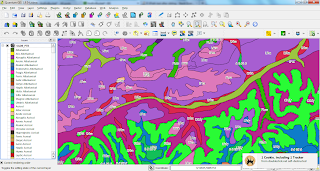
How to get from a txt-file with short names and labels to a QGIS-Style (qml-file)?
I used the below R-script to create a style for this legend table where I copy-pasted the parts I needed to a txt-file, like for the WRB-FULL (WRB-FULL: Full soil code of the STU from the World Reference Base for Soil Resources). The vector data to which I applied the style is freely available at ESDAC - you just need to submit a form to get access to the data. BTW, thanks to a helping hand on SO.
You can find the QGIS-styler script in theBioBucket-Repository on GitHub.

2 May 2013
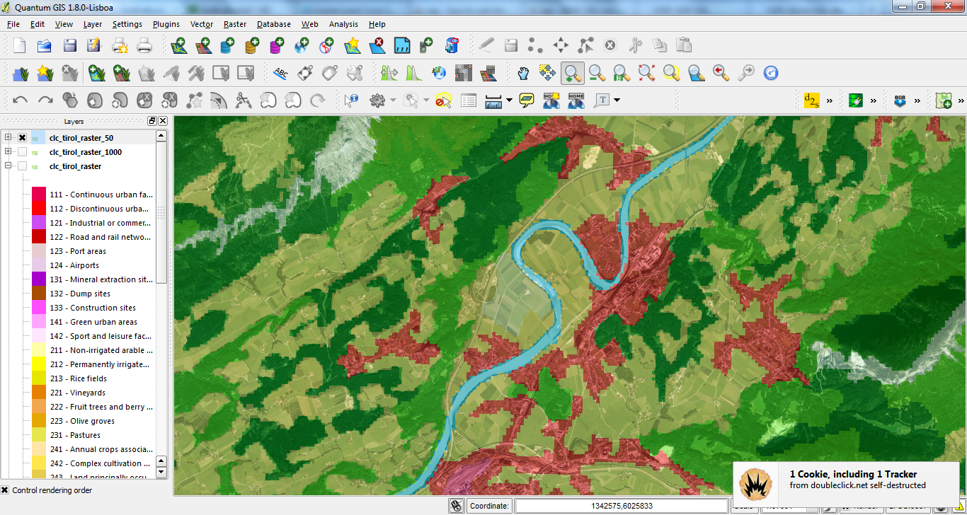
Rasterize CORINE Landcover 2006 Seamless Vector Data with OGR-rasterize
Following up my latest postings (HERE & HERE) on Corine Landcover I'll share how to rasterize this data at a desired resolution with OGR rasterize:
cd D:/GIS_DataBase/CorineLC/shps_app_and_extr/

# grab extracted and appended / merged file, created previously:
myfile=extr_and_app.dbf

name=${myfile%.dbf}

# rasterize y- and x-resolution = 50 map units:
gdal_rasterize -a code_06 -tr 50 50 -l $name $myfile D:/GIS_DataBase/CorineLC/shps_app_and_extr/clc_tirol_raster_50.tif
Processing CORINE Land Cover 2006 Seamless Vector Data with OGR/GDAL's ogr2ogr and BASH
Lately I posted about using R to programmatically download all (43 zip-files) seamless 2006 vector data of CORINE Land Cover (see here). In this follow-up I share two bash-scripts with OGR/GDAL's ogr2ogr which I used to extract features by extent (Austria/Tyrol) and to combine all seperate shp-files into one by appending the dbfs. The style I used for the map is also available with german labels HERE.
##################################################
# name: extr_by_extent.sh
# Author: Kay Cichini
# Date: 30-04-2013
# Purpose: Extract shp-file features in {infolder} by input extent
#          and save new shp-files to {outfolder} that is created on the fly
# Extent Tirol in EPSG:3035 - ETRS89 / ETRS-LAEA
# from D:\GIS_DataBase\GIS_Tirol\Tirol_Extent_LEAE-ETRS.shp
# xMin,yMin 4328054.73,2617730.23 : xMax,yMax 4547691.32,2739524.35

infolder=D:/GIS_DataBase/CorineLC/shps
outfolder=D:/GIS_DataBase/CorineLC/shps_extracted

ext='4328054.73 2617730.23 4547691.32 2739524.35'

ogr2ogr -overwrite $outfolder -spat $ext $infolder
##################################################

##################################################
# name: app_shps.sh
# Author: Kay Cichini
# Date: 30-04-2013
# Purpose: Append shp-files to newly created file

# working directory with shp-files to be appended into one file
mydir=D:/GIS_DataBase/CorineLC/shps_extracted
cd $mydir

# directory where final shp-file will be saved
mydir_final=D:/GIS_DataBase/CorineLC/shps_app_and_extr
mkdir $mydir_final

# get dbfs, which are the actual files to which append the data to
declare -a dbfs=(*.dbf)

# loop through dbfs in dir and append each to the dbf of
# 'extr_and_app.shp' that will be created by ogr2ogr on the fly
# and saved to {mydir_final}
for dbf in ${dbfs[@]}; do
  echo appending $dbf to $mydir_final/extr_and_app.dbf
  ogr2ogr -append $mydir_final/extr_and_app.dbf $dbf
done
##################################################
Subscribe to:
Posts
(
Atom
)